
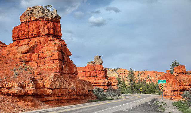
 Red Canyon: Red Canyon is a small area just a few miles from Bryce Canyon National Park. It is a popular recreation area that offers dramatic red rock formations and terrain for visitors to explore. Photo by Gary Warren/ladailypost.com
 Retired: An old wooden windmill sits in a pasture a few miles east of Zion National Park. The windmill caught my eye as the entire structure is made of wood, even the blades that remain. Just minutes before seeing this ranch area where cattle roam, drivers were navigating their way through the spectacular rock formations within Zion National Park. Photo by Gary Warren/ladailypost.com
By GARY WARREN
Photographer
Formerly of Los Alamos
When returning from the western portion of the U.S., we always enjoy traveling through southern Utah. The drive is amazing and the scenic beauty of this part of the country is magnificent. There are portions of the drive that are so wild and remote that there is almost no sign of human existence except for the highway.
It would be much faster to take I-15 at St. George until I-70 begins and leads travelers eastward. However, by taking the scenic two-lane highways, we expose ourselves to so much more beauty and opportunity for adventure. The route leads travelers by three national parks, Zion, Bryce Canyon, and Capitol Reef, and the road crosses through a small portion of the Grand Staircase-Escalante National Monument as well as the Dixie National Forest and Fishlake National Forest.
Driving these back roads also takes drivers the entire length of Utah Scenic Byway 12. The scenic byway leads visitors through stunning and varied landscapes while ranging from 5,200 feet in elevation to more than 9,600 feet at Boulder Mountain Pass. One will travel from beautiful red rock country to a section of badlands rocky terrain to aspen and pine forest before returning to the scenic red rock country at Torrey on the byway.
After passing by Bryce Canyon, there are just a handful of small communities along the scenic byway. Each of these communities has its own traits and personalities, and each is rich in history. There are smaller areas of agriculture in the lower elevations that expand in size as you travel northward. Each of the areas offers a stark and contrasting landscape compared to the rocky terrain of this part of Utah.
After passing through Torrey our route turns toward the east as we travel through the canyons and gorges of the northern portion of Capitol Reef National Park. When traveling this route, one will pass through apple and apricot orchards before winding eastward along the Fremont River toward Hanksville.
At Hanksville one must turn north or south as there is no eastward route because much of the property eastward is Canyonlands National Park.
Turning north at Hanksville leads drivers about 45 miles to I-70, which heads travelers into Colorado.
Traversing through southern Utah along the scenic route takes more time than following the Interstates but we prefer to travel the two lanes. Wherever we travel, there is so much more to see and the small towns that we pass through allow us to get a glimpse of life in small town America. Time to plan the next journey!
Editor’s note: Longtime Los Alamos photographer Gary Warren and his wife Marilyn are traveling around the country, and he shares his photographs, which appear in the “Posts from the Road” series published in the Sunday edition of the Los Alamos Daily Post.
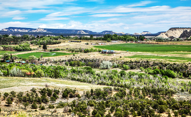
 Agriculture: A large agricultural operation was seen near Escalante, Utah. The green fields are a stark contrast to the rock formations surrounding the area. Photo by Gary Warren/ladailypost.com
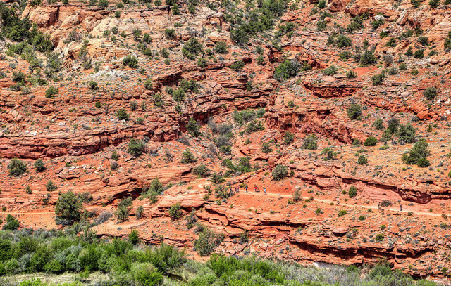 Take A Hike: A stop at a popular viewpoint on Highway 12 allows visitors to stretch their legs and view the hikers on the Calf Creek Trail across the canyon. The trail and hikers are seen just above the green trees that grow along Calf Creek in the Canyon floor. Photo by Gary Warren/ladailypost.com
 Escalante River: The Escalante River flows through the canyon near Boulder, Utah. Seen are portions of the Escalante River Trail as it meanders through the area. In the distance is the stunning landscape that makes this area in Utah so special. The green foliage can be seen as it follows the river through the rocky landscape. Photo by Gary Warren/ladailypost.com
 No Man’s Land: Looking across this massive rocky formation reveals very little human existence except for the highway passing through. Highway 12 offers drivers a chance to see country that has a very sparse population in areas, but is beautiful to travel through. Seen in the center are two motorcyclists as they travel the highway. Photo by Gary Warren/ladailypost.com
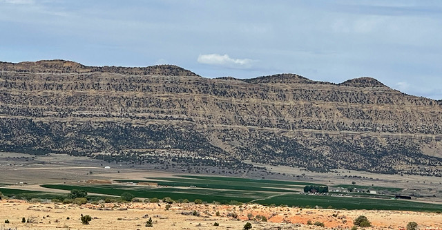
 Farm & Ranch Country: As one travels north towards Torrey, Utah, the road leads through some beautiful farm and ranch country before gaining elevation and passing through the Fishlake National Forest. The highway will reach elevations topping almost 10,000 feet, while the peaks in the forest will top out at more than 11,000 feet. The diverse landscapes and views along the highways in southern Utah offer beautiful and unique views for travelers. Photo by Gary Warren/ladailypost.com